Showing posts with label Reading. Show all posts

Thursday, 9 January 2020

Wind

Read with Franky
What is wind?
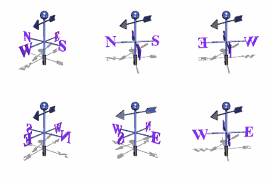
Wind is air in motion. It is produced by the uneven heating of the earth’s surface by the sun. Since the earth’s surface is made of various land and water formations, it absorbs the sun’s radiation unevenly. Two factors are necessary to specify wind: speed and direction
What causes the wind to blow?
As the sun warms the Earth's surface, the atmosphere warms too. Some parts of the Earth receive direct rays from the sun all year and are always warm. Other places receive indirect rays, so the climate is colder. Warm air, which weighs less than cold air, rises. Then cool air moves in and replaces the rising warm air. This movement of air is what makes the wind blow.
What is the jet stream?
The jet stream is a fast flowing, river of air found in the atmosphere at around 12 km above the surface of the Earth just under the tropopause. They form at the boundaries of adjacent air masses with significant differences in temperature, such as of the polar region and the warmer air to the south. Because of the effect of the Earth's rotation the streams flow west to east, propagating in a serpentine or wave-like manner at lower speeds than that of the actual wind within the flow.
What are the global wind patterns?
The equator receives the Sun's direct rays. Here, air is heated and rises, leaving low pressure areas behind. Moving to about thirty degrees north and south of the equator, the warm air from the equator begins to cool and sink. Between thirty degrees latitude and the equator, most of the cooling sinking air moves back to the equator. The rest of the air flows toward the poles.What are the trade winds?
The trade winds are just air movements toward the equator. They are warm, steady breezes that blow almost continuously. The Coriolis Effect makes the trade winds appear to be curving to the west, whether they are traveling to the equator from the south or north.
What are the doldrums?
The doldrums is an area of calm weather. The trade winds coming from the south and the north meet near the equator. These converging trade winds produce general upward winds as they are heated, so there are no steady surface winds.
What are the prevailing westerlies?
Between thirty and sixty degrees latitude, the winds that move toward the poles appear to curve to the east. Because winds are named from the direction in which they originate, these winds are called prevailing westerlies. Prevailing westerlies in the Northern Hemisphere are responsible for many of the weather movements across the United States and Canada.What is a sea breeze?
On a warm summer day along the coast, this differential heating of land and sea leads to the development of local winds called sea breezes. As air above the land surface is heated by radiation from the Sun, it expands and begins to rise, being lighter than the surrounding air. To replace the rising air, cooler air is drawn in from above the surface of the sea. This is the sea breeze, and can offer a pleasant cooling influence on hot summer afternoons.What is a land breeze?
A land breeze occurs at night when the land cools faster than the sea. In this case, it is air above the warmer surface water that is heated and rises, pulling in air from the cooler land surface.
To Know more....


Task: After reading, make the summary of the main ideas

Monday, 17 February 2014

European rivers


Major Rivers of EUROPE
Hundreds of rivers and their tributaries cross the European continent. Here we highlight those over 600 miles in length, and a few others of note.

DANUBE

Beginning in the Black Forest region of Germany, it flows across central Europe and the countries of Austria, Hungary, Croatia and Yugoslavia. It then forms the border between Romania and Bulgaria, turning north across Romania to eventually end in the Black Sea. It's (1,771 miles) (2,850 km) in length, and one of the most significant commercial waterways on the continent.

DNIEPER

Rising in the southwestern part of the Russian Federation, it flows generally south through Belarus, then southeast through Ukraine, ending in the Black Sea. Overall it's (1,420 miles) (2,285 km) in length.

DON

Beginning it the southwestern Russian Federation, to the south of Moscow, it flows southeasterly towards the Volga, then turns abruptly west, ending in the Sea of Azov. Overall it's (1,224 miles) (1,969 km) in length.

ELBE

Forming in the Czech Republic, the Elbe River then flows north through Germany, ending in the North Sea near Cuxhaven. It's (724 miles) (1,165 km) in length.

LOIRE

Recognized as the longest river in France, the navigable Loire begins in the foothills of the Massif Central, then flows north and west across the heartland of France, finally ending in the Bay of Biscay. It's (634 miles) (1,020 km) in length.

ODER

Rising in the rugged mountains of the eastern Czech Republic, it flows west and north through south-central Poland, eventually emptying into the Baltic Sea. It's (567 miles) (912 km) in length.

PO

Italy's longest river begins in the upper reaches of the Alps, flowing west to east across northern Italy, ending in the Adriatic Sea. It's (405 miles) (652 km) in length.

RHINE

Forming in the mountains of southeastern Switzerland, this legendary river flows west, forming Switzerland's northeastern border with Germany, then runs directly north through western Germany forming part of that country's border with France, then finally dissecting the Netherlands and ending in the North Sea. Numerous tributaries and branches run in all directions, and in overall length is (820 miles) (1,319 km).

RHONE

Begin high in the Swiss Alps, this fast moving river flows into the eastern end of Lake Geneva, then south through south-eastern France, emptying into the Mediterranean Sea. Small branches run in all directions, and in overall length, it's (300 miles) (485 km).

SHANNON

Rising in northwestern Ireland, it flows south through a series of lakes, then turns west to eventually empty into the Atlantic Ocean. It's 230 miles (370 km) in length.

TAGUS

The Tagus River rises in the central highlands of Spain, flowing southwest across Portugal, then south to Lisbon and the Atlantic Ocean. It's 626 miles (1,007 km) in length.

THAMES

This historic river rises in western England in the Cotswold Hills, then flows east across southern England, (right through London) to empty into the North Sea. It's 210 miles (338 km) in length.

VISTULA

Rising on the slopes of the Carpathian Mountains in southwestern Poland, this river flows through the central part of that country, and on into the Baltic Sea. It's 675 miles (1,086 km) in length.

VOLGA

The Volga River, the largest and longest river system is Europe rises in the hills just northwest of Moscow, and then flows 2,300 miles (3,700 km) to the east and southeast before emptying into the Caspian Sea. More than 200 tributaries merge with the main river, including the Kama, Samara and Oka. And in fact, the Volga and its tributaries occupy a watershed covering about 560,000 sq. mi. (1,450,000 sq. km), which is almost 41% of the European landmass. When a series of canals were finished in the early 19th century - canals that eventually linked the Volga and the Baltic Sea - economic development along the river increased dramatically.


Task: Which are the top 10 main european rivers? Where are located?

Tuesday, 5 November 2013

Reading about droughts with Cody


We  read about droughts, use this link to read different texts or this page
After that you have to make the control text 

Send me the  control text